
Zalesina
Zalesina | |
|---|---|
Village | |
 Train station in Zalesina, Croatia | |
 | |
| Country | |
| Area | |
• Total | 7.9 km2 (3.1 sq mi) |
| Population (2021)[2] | |
• Total | 31 |
| • Density | 3.9/km2 (10/sq mi) |
| Time zone | UTC+1 (CET) |
| • Summer (DST) | UTC+2 (CEST) |
Zalesina is a village in Croatia. It is connected by the D3 highway.
History
[edit]In 1860–1879, Matija Mažuranić wrote a 62 folio manuscript today titled Writings on the Building of Roads in Gorski Kotar and Lika (Croatian: Spisi o gradnji cesta u Gorskom Kotaru i Lici), today with signature HR-ZaNSK R 6424.[3]: 223
From 31 January to 2 February 2014, while S and SW geostrophic wind dominated,[4] freezing rain fell on Gorski Kotar, glazing the entire region. It wrecked roofs, power lines an forests, causing power loss for about 14,000 households households in Gorski Kotar, or about 80% of its population. Because of power lines falling on the A6, the highway was closed in of Rijeka between Bosiljevo and Kikovica, and between Kikovica and Delnice in the direction of Zagreb.[5] It took about 10 days to restore essential infrastructure to the region, and within months electricity was back in most of its former range, but at a cost of about 84.4 million HRK to HEP. At the time it was the largest peacetime damage since its Secession from Yugoslavia, even without counting the forestry losses.[6] Clearing blocked forestry roads and forest paths would take years, and thanks to the declining population some were never cleared.[7]
Climate
[edit]Between 1981 and 2000, the highest temperature recorded at the local weather station was 31.8 °C (89.2 °F), on 3 August 1981.[8] The coldest temperature was −33.4 °C (−28.1 °F), on 6 January 1985.[9]
Sports
[edit]The "Gorski Kotar Bike Tour", held annually since 2012,[10] sometimes goes through Zalesina, such as in the second leg for 2024.[11]
Gallery
[edit]-
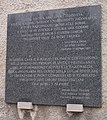 WWII plaque
 -
 Old beech tree


References
[edit]- ^ Register of spatial units of the State Geodetic Administration of the Republic of Croatia. Wikidata Q119585703.
- ^ "Population by Age and Sex, by Settlements" (xlsx). Census of Population, Households and Dwellings in 2021. Zagreb: Croatian Bureau of Statistics. 2022.
- ^ Jurić, Šime (1980-11-20). "Rukopisna građa u Nacionalnoj i sveučilišnoj biblioteci u Zagrebu koja se tiče Istre, kvarnerskih otoka, Hrvatskog primorja, podgorja i Gorskog kotara". Vjesnik historijskih arhiva u Rijeci i Pazinu (in Croatian) (23): 215–223. ISSN 0351-0891.
- ^ Trošić, Tanja; Mokorić, Marija (2014). ""Ledena kiša" i poledica u Gorskom kotaru od 31. siječnja do 5. veljače 2014". Meteorološki i hidrološki bilten (4): 49–53. ISSN 1334-3017.
- ^ Tatar, Nensi (2014-02-02). "ZBOG LEDENE KIŠE IZUZETNO TEŠKI VREMENSKI UVJETI U GORSKOM KOTARU: Grad Vrbovsko imenovao i poseban Stožer zimske službe koja je tijekom ovih dana na raspolaganju svim stanovnicima". Gorke novosti. Archived from the original on 2014-02-02.
- ^ Ned (2014-04-11). "Ledena kiša u Gorskom kotaru uzrokovala najveću mirnodopsku štetu u Hrvatskoj". Crometeo - motrenje i prognoziranje vremena. Archived from the original on 2014-04-13.
- ^ Uredništvo (2014-02-28). "Ledena kiša u Gorskom Kotaru". Šumarski list. 138 (1–2): 5. eISSN 1846-9140.
- ^ DHMZ (2022-07-19). "Najviše izmjerene temperature zraka u Hrvatskoj za razdoblje od kada postoje mjerenja". Državni hidrometeorološki zavod.
- ^ DHMZ (2022-01-21). "Najniže izmjerene temperature zraka u Hrvatskoj za razdoblje od kada postoje mjerenja". Državni hidrometeorološki zavod.
- ^ Kušić, Tatjana (2018). "Izvještaj o radu Turističke zajednice Grada Vrbovskog za razdoblje siječanj - prosinac 2018" (PDF). Visit Vrbovsko. Archived from the original (PDF) on 2021-10-26.
- ^ Promotiv Travel (2024). "Gorski kotar Bike Tour 2024". Promotiv. Archived from the original on 2024-02-28.
45°23′N 14°52′E / 45.383°N 14.867°E
This Primorje-Gorski Kotar County geography article is a stub. You can help Wikipedia by expanding it. |